
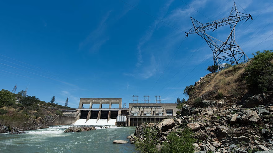
Trails Near Keswick Dam Follow Water and Old Rail Lines
Trails near Keswick Dam are shaped by the Sacramento River, Keswick Reservoir, old rail corridors, and the edges of Redding. Some routes are paved and bike-friendly. Others feel more like exposed foothill paths. The right choice depends on heat, distance, shade, bike traffic, and how close you want to stay to the river.
The Bureau of Reclamation's Keswick Dam page identifies the dam as part of Sacramento River operations downstream from Shasta Dam. That water-management setting explains why trails in the area often follow river corridors, utility routes, and reservoir edges.
Pick the trail for the day you have, not only the map distance.
Sacramento River Rail Trail
The Sacramento River Rail Trail is the headline route for many visitors near Keswick Dam. It follows a former rail corridor along the river and reservoir area, making it appealing for walkers, runners, cyclists, and people who like gentle grades.
BLM's Sacramento River Rail Trail page is the source to check for current access, permitted uses, and route details. Because the trail is popular with bikes, walkers should stay aware on curves and narrow sections.
For broader trail-planning habits, Livecub's walking stick adjustment guide is useful if you are mixing paved miles with rougher side paths.
Rail-trail grade does not mean no effort in summer heat.
Keswick Dam Trailhead and Nearby Access
Many visitors think first about the dam, then realize the exact access point matters. Parking, closures, security boundaries, and trail connections can change what makes sense. Do not assume you can wander freely near dam structures.
Use signed public trailheads and respect closure areas. The dam is working infrastructure, and some areas are not meant for casual exploring. If a gate, fence, or sign says no access, choose another viewpoint.
For another place where access shapes the experience, Livecub's Spiral Jetty guide shows why road and site conditions matter before arrival.
Choose a Surface That Fits Your Group
Near Keswick, surface choice matters as much as scenery. Paved trail is better for casual bikes, strollers, and visitors who want predictable footing. Dirt or gravel sections can feel more natural but may be dusty, uneven, or slippery after weather.
Ask one practical question before starting: who is the least comfortable person in the group? A route that fits that person is usually the right route. Trail days go badly when the strongest walker chooses for everyone else.
Good trail planning starts with the slowest return pace.
Sacramento River Trail Connections
The wider Redding trail system can turn a short Keswick outing into a longer river day. Depending on your starting point, you may connect toward paved river routes, bridge viewpoints, parks, and shaded sections closer to town.
Plan the return before you start. Out-and-back routes feel easy at first because the river and grade pull you forward. The return can feel hotter, longer, and more exposed, especially with children or a casual bike group.
Half the route is still waiting after you turn around.
Whiskeytown National Recreation Area Side Trips
Whiskeytown National Recreation Area sits close enough to pair with a Keswick-area trip if you have a full day or weekend. It offers different scenery: lake views, waterfalls, forested paths, and steeper options than the rail trail.
The National Park Service's Whiskeytown hiking page is the place to check for trail status, fire recovery notes, distance, and difficulty. Conditions can change, so verify before driving over.
For a waterfall-focused comparison, Livecub's Skyline Drive waterfalls article shows how water hikes can vary with season and recent weather.
Best Routes for Bikes
Bicyclists often prefer the paved and rail-trail sections because grades are manageable and the route is scenic. Still, check trail rules, surface condition, and traffic before assuming the whole route fits every rider.
Use a bell or voice when passing, slow near families and dogs, and keep speed reasonable on turns. A trail can be wide in one section and narrow quickly near bridges, slopes, or vegetation.
If you are mixing bikes and sightseeing, build in time for stops. The area is not only a workout corridor; river views, dam context, and shaded breaks are part of the value.
Best Routes for Walking With Kids
Families should choose shorter segments with clear turnaround points, shade when possible, and easy parking. A paved mile near the river can be better than a longer route with heat, bikes, and no bathroom plan.
Bring water, snacks, hats, and a simple rule for bikes passing from behind. Kids may drift across the path when they are watching the river, wildlife, or rocks.
Livecub's North Conway moose viewing guide is a different region, but it shares the same family-travel lesson: wildlife and scenery are better when the group is comfortable.
Heat, Shade, and Water
Redding can be hot, and exposed trail sections near Keswick can feel hotter than the forecast suggests. Start early during warm months, carry more water than you expect to need, and avoid pushing a midday route just because the mileage looks small.
Shade is not evenly distributed. Some river sections feel pleasant, while exposed pavement can radiate heat. Dogs need extra caution because pavement temperature and limited shade can make a short walk unsafe.
In this area, distance is only one part of difficulty.
What to Bring for a Keswick Trail Day
Bring water, sun protection, a hat, a charged phone, a simple map, and shoes that handle pavement and dusty edges. Cyclists should add a repair kit and lights if they might be out near evening.
If you are walking with kids or dogs, pack more water than the mileage seems to require. Snacks, a small first-aid kit, and a plan for bathroom stops can turn a hot day from stressful to manageable.
The short trail still deserves a real kit.
Dogs on the Trails
Dogs can enjoy the Keswick area, but heat, pavement, bikes, and river edges need attention. Keep the leash short enough to control passing moments and avoid letting the dog drift across the path when cyclists approach.
Check paws often in warm weather. If pavement feels hot to your hand, it is too hot for a long dog walk. Bring a bowl and water, and choose shaded times of day rather than forcing a midday outing.
Fishing, River Views, and Quiet Stops
Some visitors use the trails for access to river views, fishing spots, birding, or a quiet walk rather than a long hike. That is a good fit for Keswick if you plan around legal access and respect posted rules.
Water levels and flows can change because the Sacramento River system is managed. Stay off slick edges, watch children near water, and do not treat a calm-looking bank as automatically safe.
For another western travel comparison, Livecub's Laughlin travel ideas shows how river corridors often mix recreation, infrastructure, and scenic stops.
How to Plan a Half-Day
For a half-day near Keswick Dam, choose one primary route and one backup. Start early, park at a signed trailhead, walk or ride out for a set time, then turn around before heat or fatigue builds. Add a shaded lunch stop afterward.
If you want more variety, combine a short rail-trail segment with a Whiskeytown stop or a Redding river viewpoint. Do not try to cover every trail in one visit. The best day is usually the one that leaves enough energy for the return.
For long-view destination planning, Livecub's Petoskey travel guide is another example of choosing a few good stops instead of crowding the day.
When to Go
Spring and fall often feel best for longer outings because temperatures are easier to manage. Summer can still work if you start early and stay realistic. Winter may be quieter, but storms and wet surfaces can change footing.
Check current conditions before driving, especially after fire recovery work, heavy rain, heat advisories, or maintenance closures. A backup route in Redding or Whiskeytown keeps the day from turning into a parking-lot argument.
Frequently Asked Questions
Is the Sacramento River Rail Trail near Keswick Dam paved?
Key sections are paved and popular with walkers and cyclists, but check BLM information for current route details and conditions.
Can you bike near Keswick Dam?
Yes, bike-friendly paved and rail-trail routes are a major draw, but riders should follow posted rules and pass walkers carefully.
Are there hikes near Keswick Dam for families?
Yes. Choose short segments with clear parking, shade when possible, water, and easy turnaround points, especially in warm weather.
Is Whiskeytown close enough to add?
Yes, Whiskeytown National Recreation Area is close enough for a side trip, but check NPS trail status before you go.

Chiara Bradshaw
Covers education, culture and creative topics with an emphasis on readable explanations and verifiable references.




Leave a reply
Replying to